
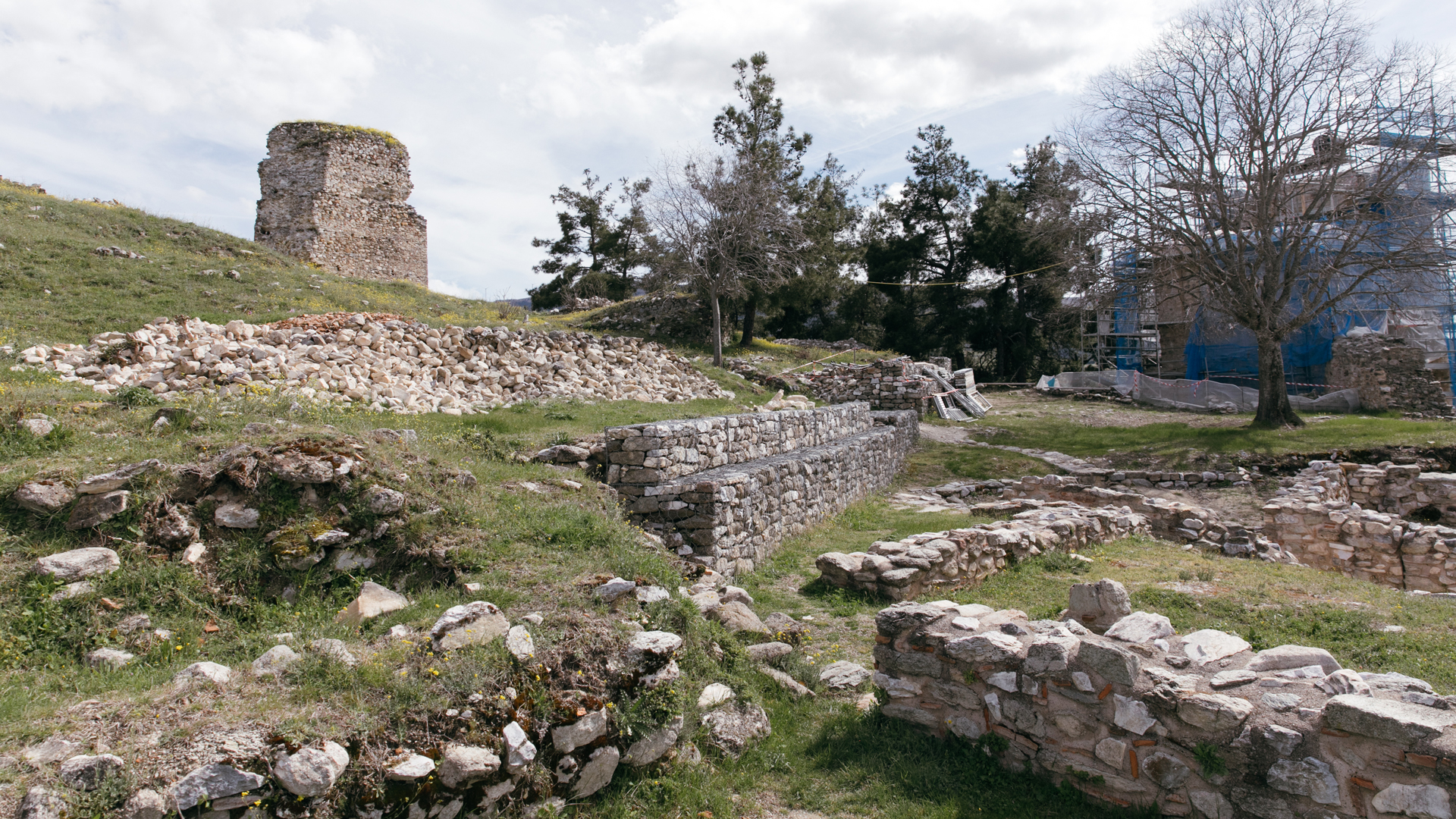
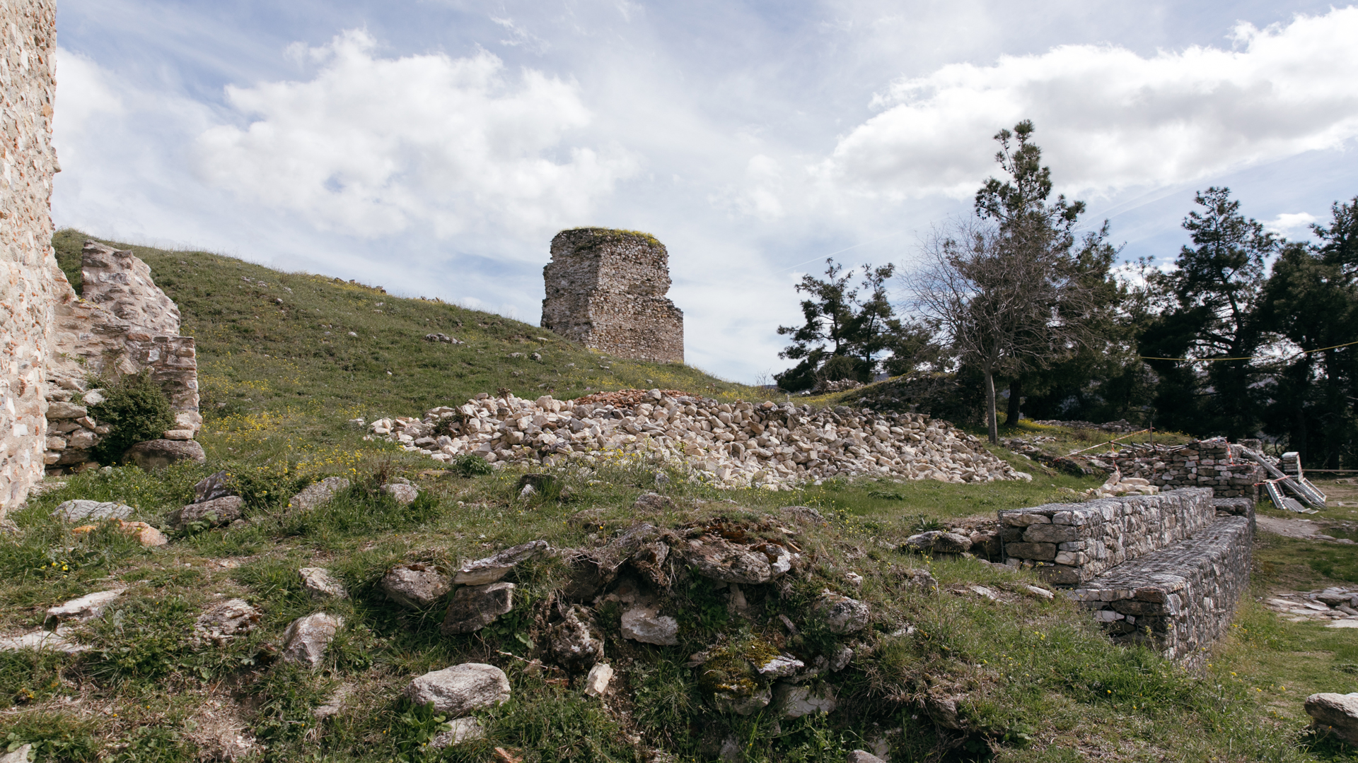
BYZANTINE CASTLE
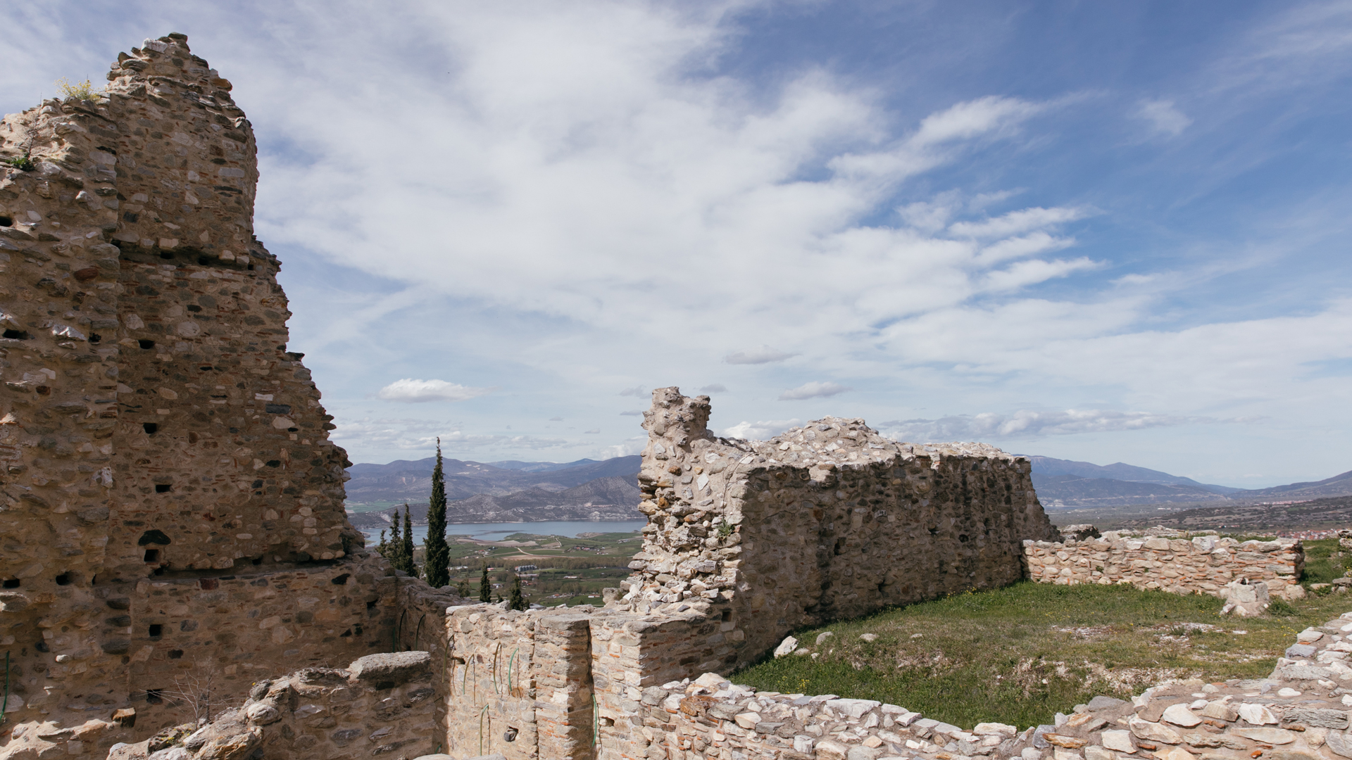
The Acropolis of Servia covered an area of about 2,500 sqm. It was part of the great Byzantine Castle Town, built between 560 and 650 AD, among the Pierian and the Kamvounia Mountains.


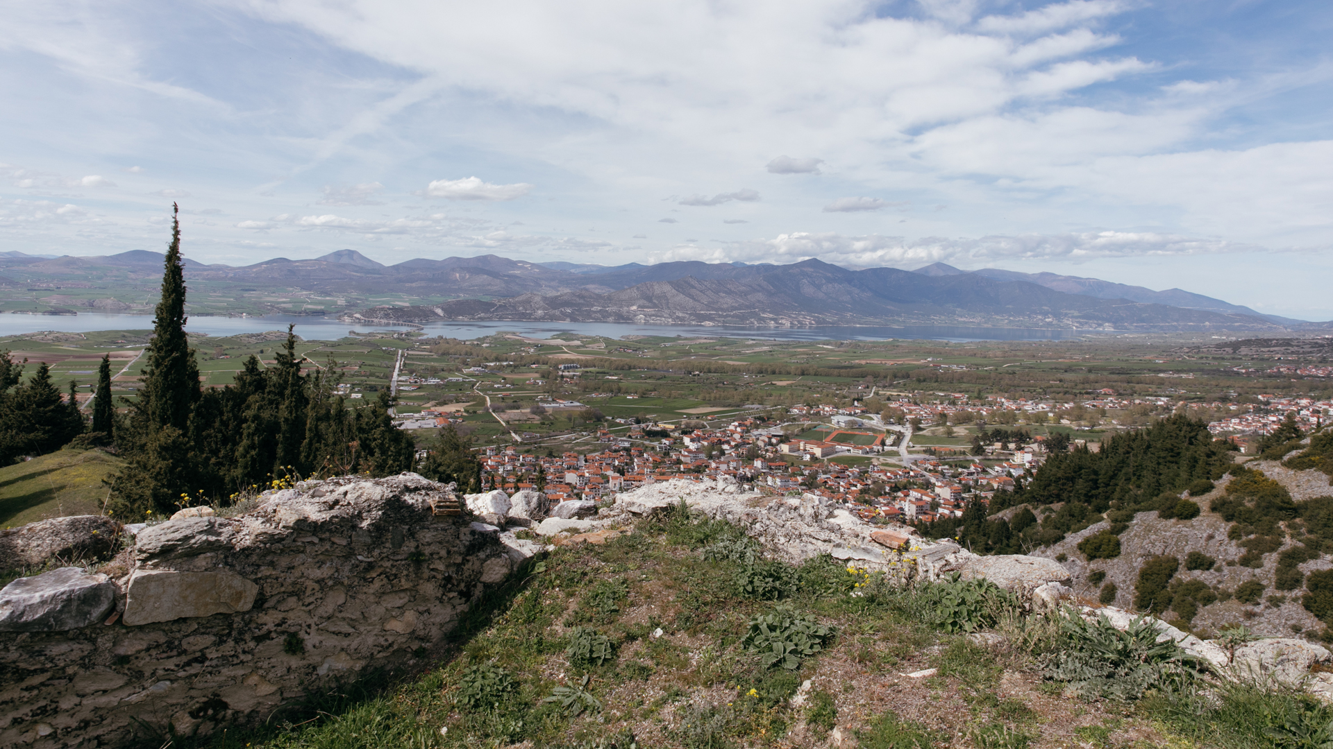
During the Byzantine era, Servia, due to its geographical location, played the role of an observatory, guarding the narrow passage from Macedonia to Thessaly.

1/8
2/8
3/8
4/8
5/8
6/8
7/8
8/8
The Ottomans were worried, so they came up with a plan based on a local Christian whom they had approached and recruited, and had promised him a beautiful woman and a large house, so that they could take the Byzantine citadel of Servia through treachery. The " fake monk" put on a cassock, entered the castle and notified the Ottomans of the coming feast of the Resurrection. So, that evening, they tied candles to the horns of the goats and led them to the castle gate. The villagers thought it was a procession of Christian people and opened the gates to welcome them. Then the Ottomans rushed into the castle and took it over.
It was not the first time that the castle "fell", but it was to be the last, since during the period of Turkish occupation that followed the fall, the Byzantine acropolis was abandoned, while the lower town and the part outside of the walls remained densely populated. The castle was built between 560 and 650, that is, during the reign of Ioustinianos or Heraclius. Since then, many conquerors have passed through, at the end of the 10th century the castle was occupied by the Bulgarian Tsar Samuel, and in 1001 it was recaptured by Basil the Second, the Vulgar Killer. In 1018, Basil the Second partially destroyed the walls so that the castle could not be used as an outpost for the Bulgarian army. In 1204, Servia was occupied by the Franks, and in 1216 it came into the possession of the Epirus governor Theodoros Doukas. Michael the Second Duke, after the battle of Klokotnica (1230), rushed to occupy the castle and immediately repaired the walls. Since 1257, Servia belonged to the Emperor of Nikaia, Theodore the Second Laskaris. In 1341, they passed into the hands of the Serbian Kralli Stefan Dusan, and in 1350 they were recaptured by John the Sixth Kantakouzenos, only to be overrun by the Ottomans for the last time in 1393, who began to build the new settlement outside the castle.
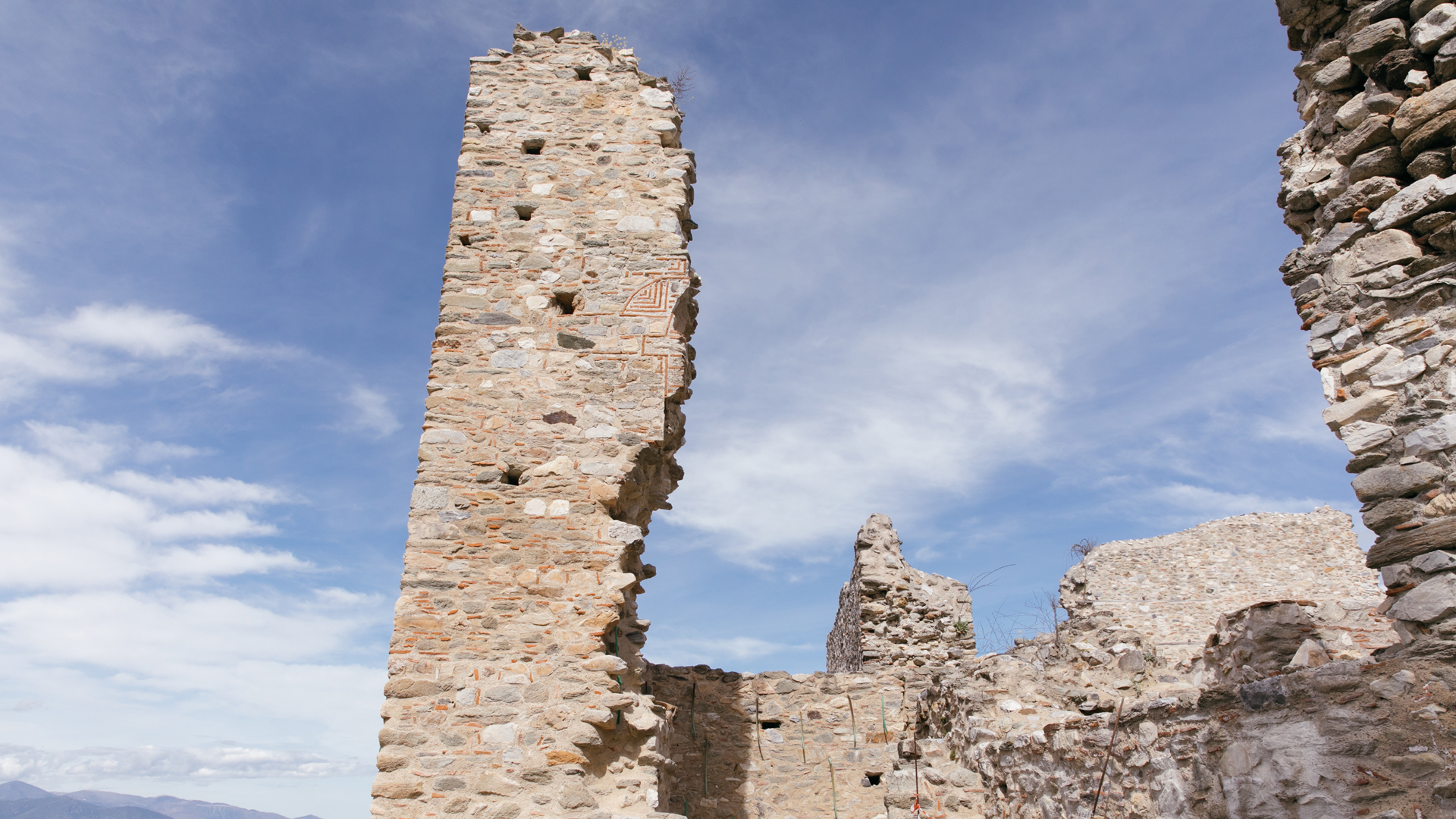
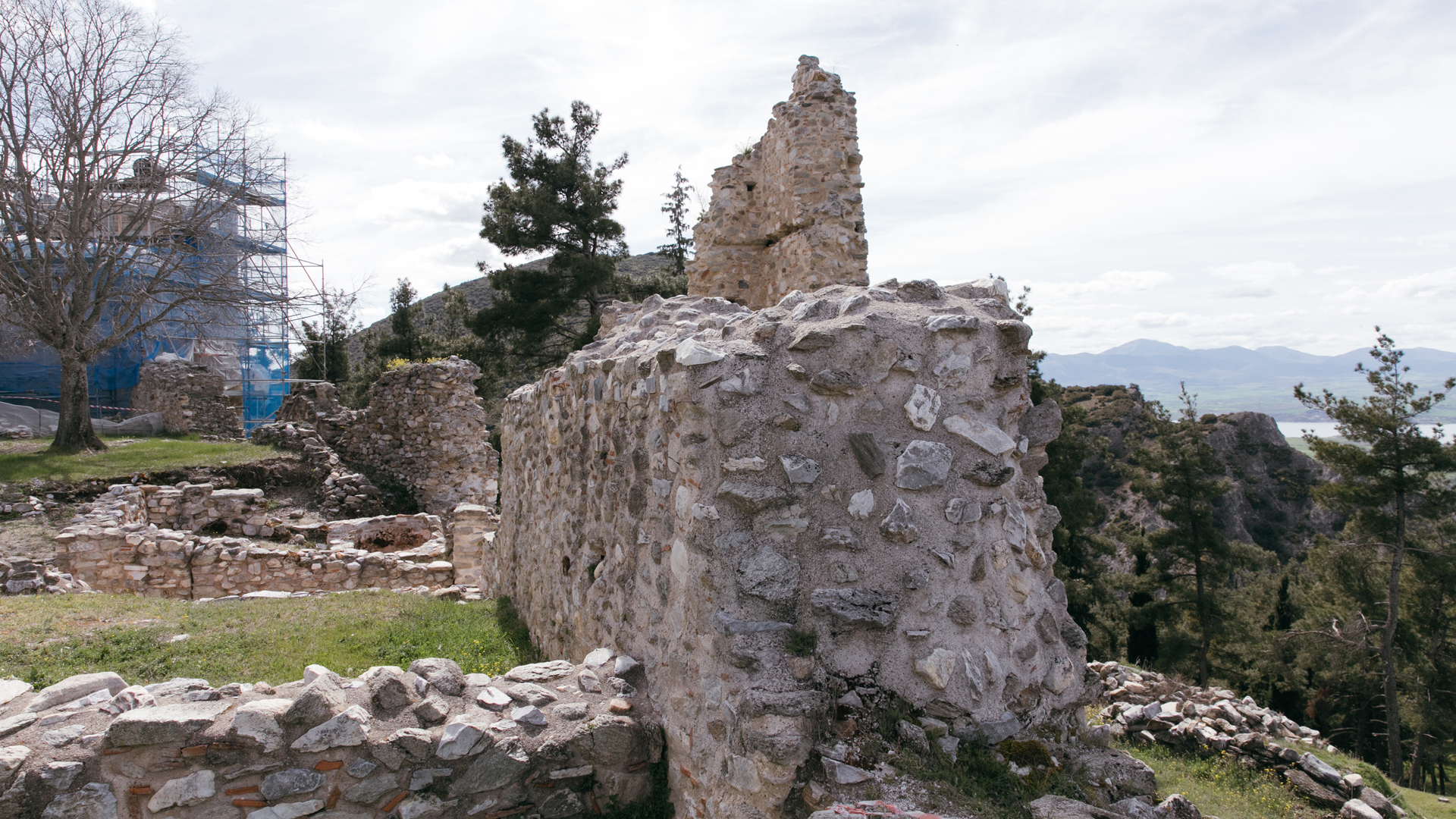
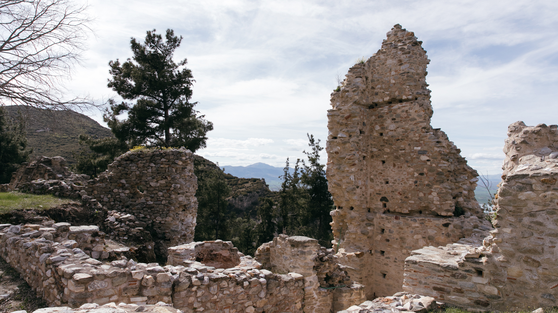
The acropolis of an area of 2.5 hectares, with its stunning view, is now deserted. There are no longer any Byzantine lords to inhabit it. Only its three Christian churches (Agii Theodoroi, Agii Anargyroi and, of course, the Basilica of Katihomenoi), which were not converted into mosques, but were repaired and rebuilt and continued to operate until the 19th century, when the old settlement was finally abandoned.


Until today, the towers, which stood more than 20 metres high, large parts of the walls and traces of buildings are still preserved in the acropolis. The western tower, 18 metres high, had three storeys, separated by wooden floors, while the northern tower is only half preserved since it was damaged during the Second World War. The southern tower is solid. It is circular at its base and pentagonal in the remaining part, while the eastern tower is triangular in shape and survives up to the height of the foundation. At the same time, inside the castle there are fountains, cisterns, the bases of several houses, traces of aqueducts and, of course, the walls that surrounded the fortress.
The 'crown' of Servia still stands at the top of the conical hill, resisting the centuries, reminding everyone of the rich history of the region.
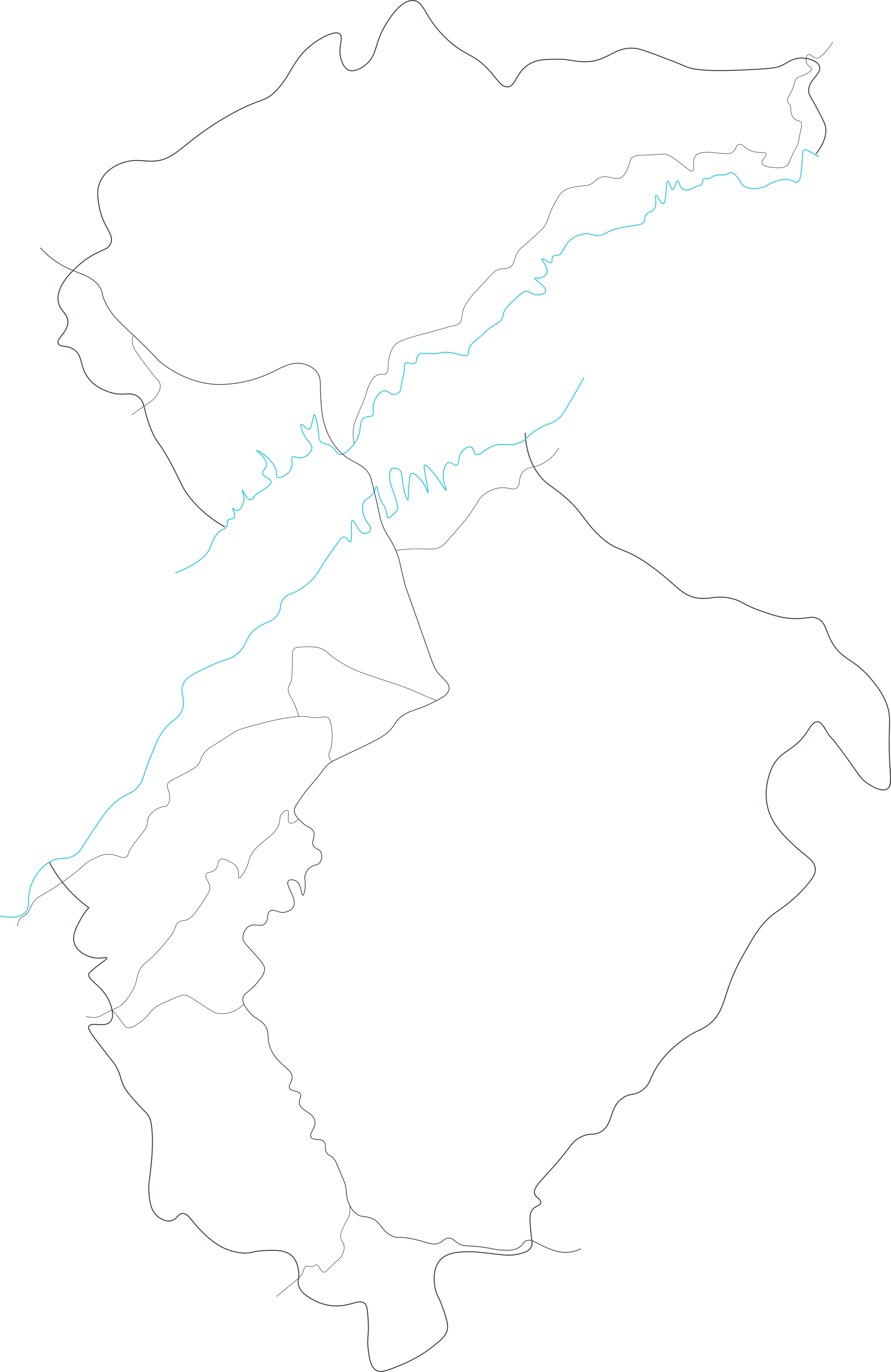
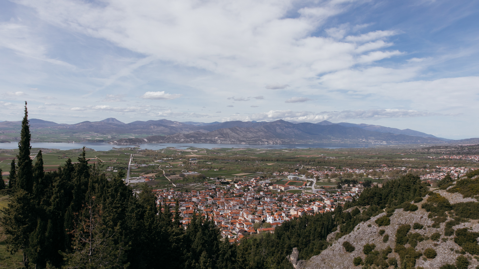
HALIACMON RIVER
It is the longest river in Greece, gathering the water of the mountains of Western and Central Macedonia, and giving life to a large part of the country before flowing into the Gulf of Thermaikos.
- The Castle
- The Town
- The River


Folklore Museum
Housed in the home of Dr. Aristidis Christakis, the purpose of the museum is the preservation and dissemination of the historical heritage and tradition of the region.


Servia
The name “Servia” derives from the Latin verb "servo" meaning "to watch, observe", reflecting the city's position as an impregnable fortress in earlier times.


Haliacmon River
It is the longest river in Greece, gathering the water of the mountains of Western and Central Macedonia, and giving life to a large part of the country before flowing into the Gulf of Thermaikos.
Download the app

