
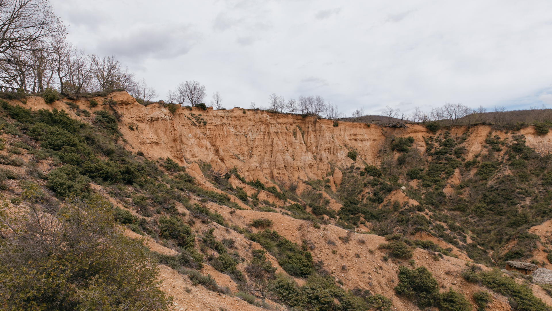
MPOUCHARIA
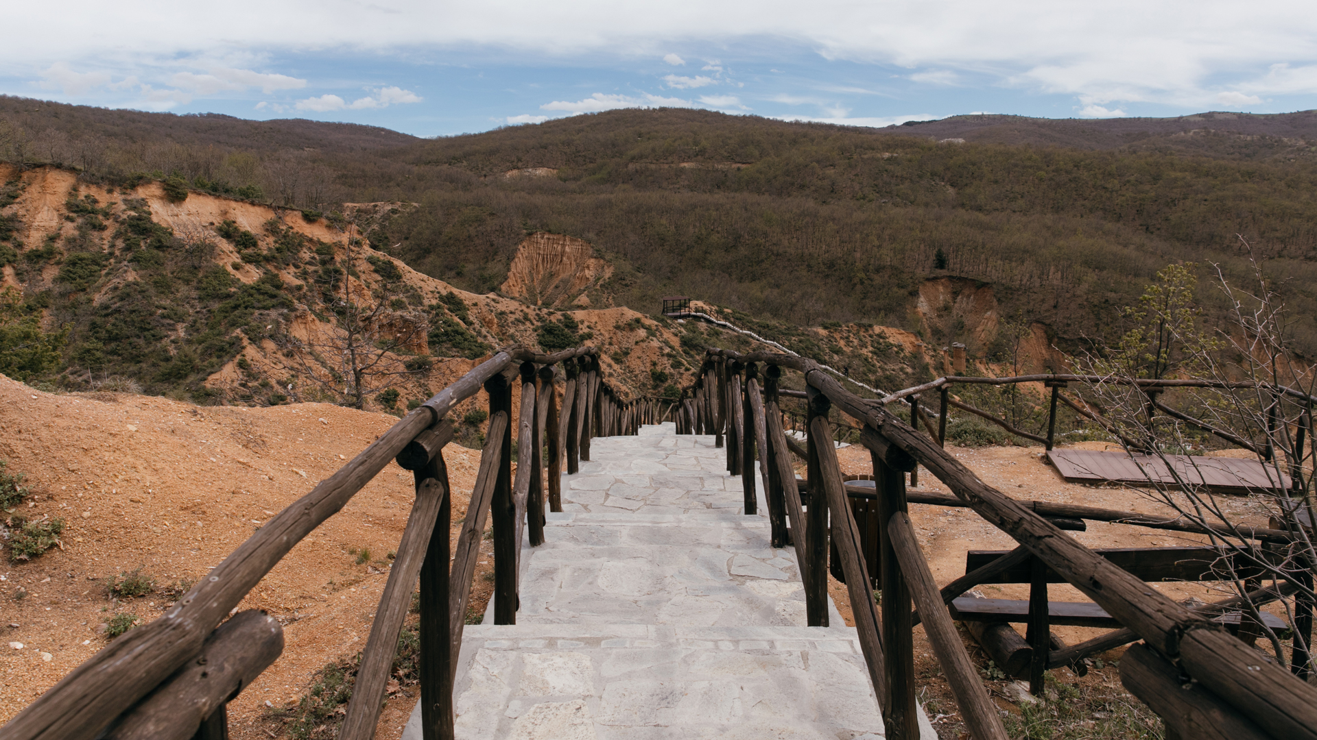
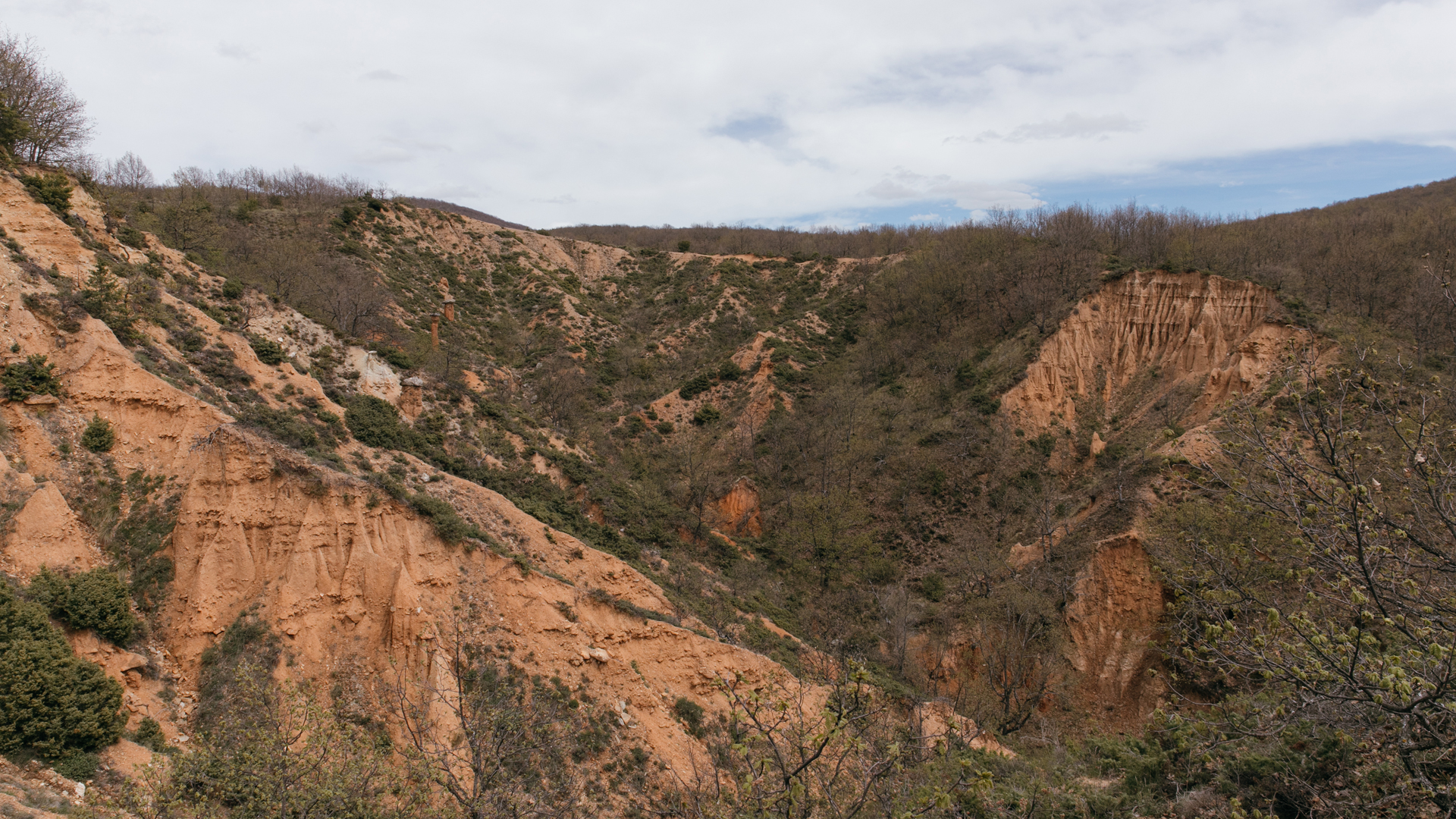
It is an impressive geological phenomenon, unique in Greece, highlighting the artistic disposition of nature. Mpoucharia are natural landforms resulting from soil erosion over thousands of years.


Their name comes from their shape resembling a large chimney, as this is what "mpouchari" means in the local dialect.
1/10
2/10
3/10
4/10
5/10
6/10
7/10
8/10
9/10
10/10
Around 1920, Thomas Gandaras, the infamous outlaw, paused for a moment, gazing across the moonlit landscape. Even though it was well past midnight, the full moon illuminated the area, revealing peculiar formations that resembled giant chimneys, known locally as "Mpoucharia." Legends of devils emerging from these chimneys under the cover of night had circulated among the villagers. Thomas Gandaras, considering this eerie spot—feared by all—as an ideal hideout for himself and a secure location to bury his ill-gotten treasures.
This was the tale the grandfather recounted to his grandson as they settled in for the night, but the young boy was never tired of hearing it. The night was warm, and the sound of Nazi occupiers' vehicles had long faded from the village. Families seeking refuge had hidden on the inhospitable yet safe slope near the Mpoucharia.
Many years have passed since that fateful night. The Nazis are gone, and the great outlaws are now the stuff of books and songs. Even the legends surrounding these extraordinary geological formations have been forgotten. Today, visitors are not gripped by fear as they approach, but rather by awe at the marvels of nature, unparalleled in Greece.

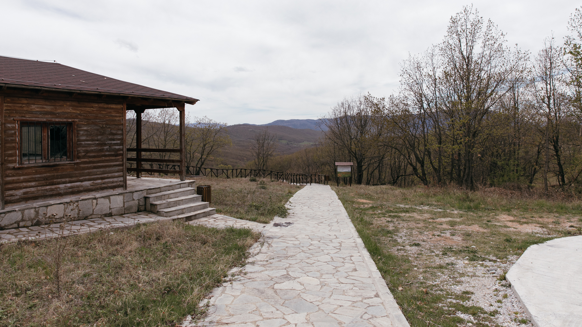
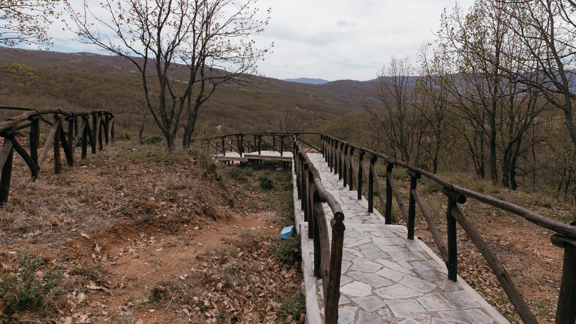
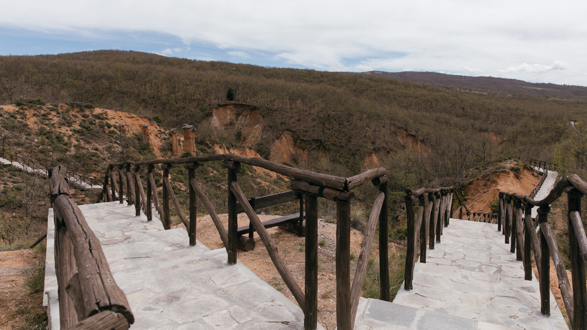
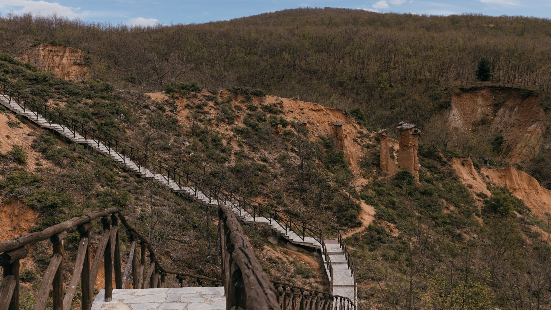
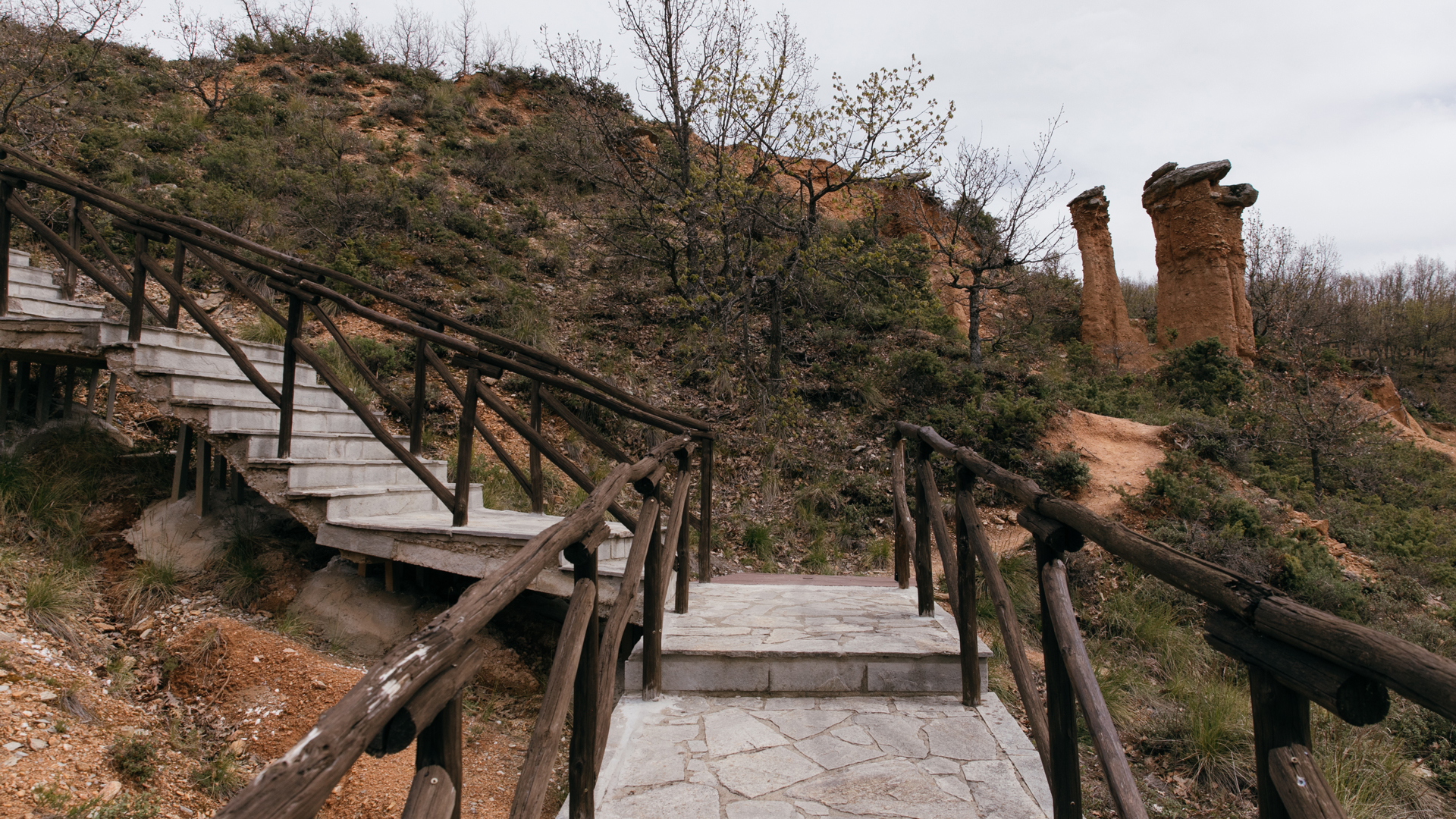
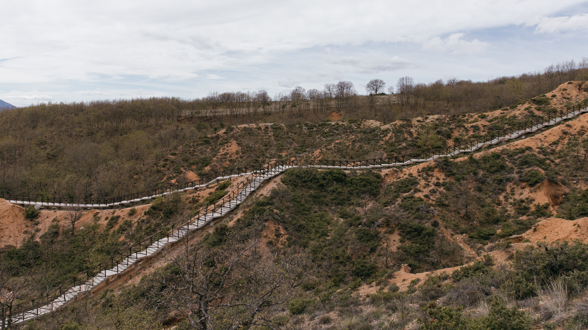
At Mikrovalto, in the municipality of Servia, along the road to Livadero, the landscape is truly unique. Over time, sand, gravel, marls, and clay, combined with iron oxides and silica as natural "glue," have worked together harmoniously to create columns that can reach heights of up to 7 meters and widths of 2.5 meters, each capped with a slate rock. The largest of these colossal columns are aptly named "Atlantes."
Since October 2007, this site has been designated as a geopark. A picturesque path guides visitors among the approximately 20 formations, allowing them to admire these natural wonders up close. Following the same path for about a kilometer beyond the last "Atlantes," the landscape changes. The Mpoucharia gradually yield to the Nohtaria, which are striking, cone-shaped formations without the characteristic "stone hat" but ending in relatively sharp peaks, resembling elegant cones. The underlying cause is the same: the passage of time and the effects of erosion on the rocks, creating a landscape reminiscent of Cappadocia. It's no wonder that this area is often referred to in tourist guides as "Little Cappadocia."
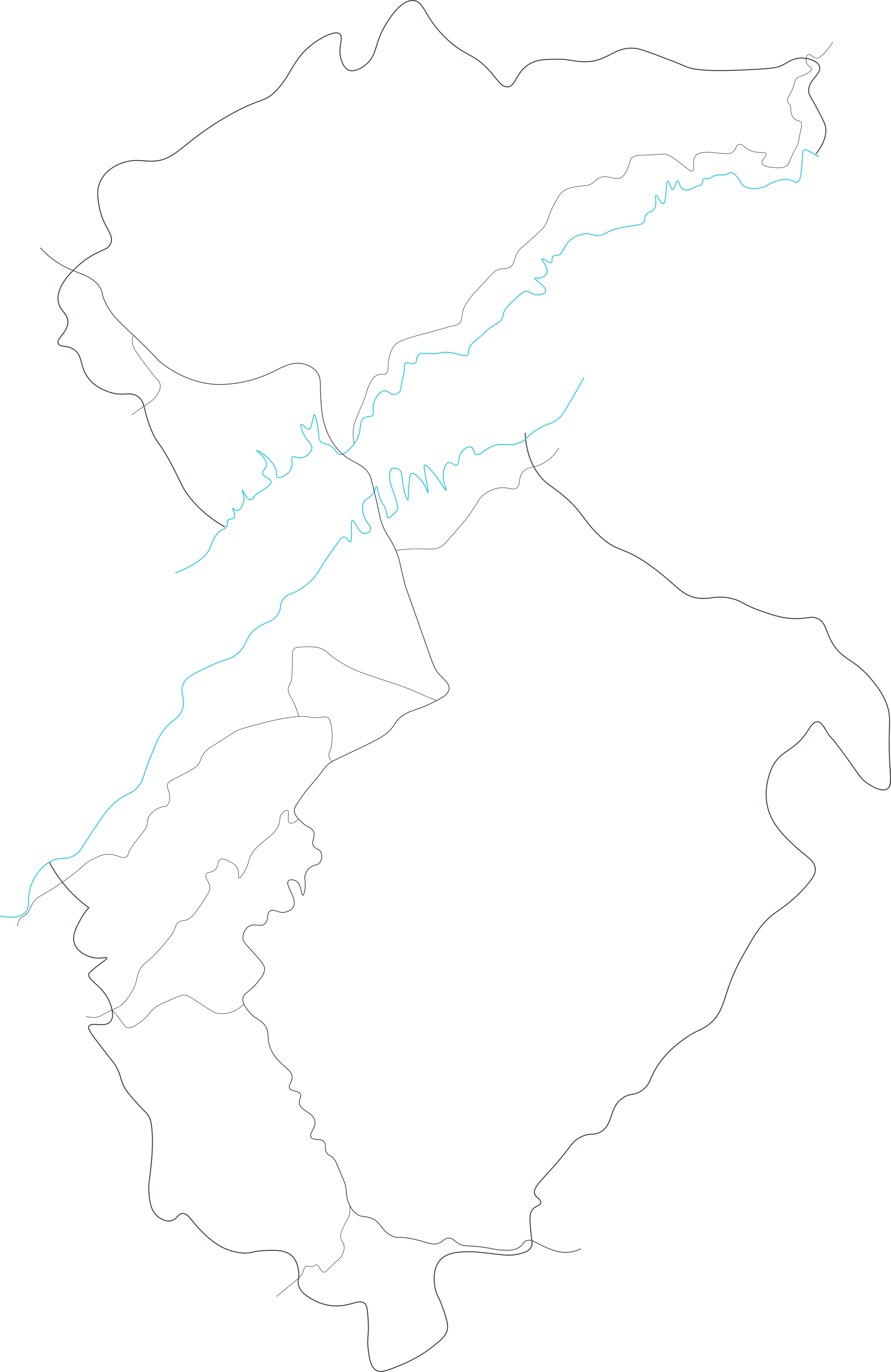
HALIACMON RIVER
It is the longest river in Greece, gathering the water of the mountains of Western and Central Macedonia, and giving life to a large part of the country before flowing into the Gulf of Thermaikos.
- The Castle
- The Town
- The River


Folklore Museum
Housed in the home of Dr. Aristidis Christakis, the purpose of the museum is the preservation and dissemination of the historical heritage and tradition of the region.


Servia
The name “Servia” derives from the Latin verb "servo" meaning "to watch, observe", reflecting the city's position as an impregnable fortress in earlier times.


Haliacmon River
It is the longest river in Greece, gathering the water of the mountains of Western and Central Macedonia, and giving life to a large part of the country before flowing into the Gulf of Thermaikos.
Download the app

